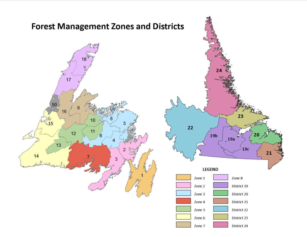
Prior to the start of forestry operations, erosion-susceptible areas in flood plain watersheds must be identified to prevent erosion during forest harvesting, including Corner Brook Stream and Bell’s Brook watersheds.
The Department of Fisheries, Forestry and Agriculture’s Crown Zone 6 Five-Year Forestry Operating Plan has been given the green light from government. However, there are conditions. Prior to the start of forestry operations, erosion-susceptible areas in flood plain watersheds must be identified to prevent erosion during forest harvesting, including Corner Brook Stream and Bell’s Brook watersheds. A Greenhouse Gas Management Plan (GGMP) must be submitted for approval by the Minister of Environment and Climate Change. A draft plan must be submitted within six months of the date of the minister's decision letter with the final plan to be submitted within one year of the decision. As well, a 30-metre protective buffer is needed around active hydrometric stations and a 100-metre buffer is required along the shoreline of South Brook and Lomond River. Robinson’s River and Middle Barachois River, will be designated a Sensitive Wildlife Area for endangered plants and species.
 Schools to remain closed Friday morning due to weather
 Corner Brook MHA Jim Parsons gives first speech in the House of Assembly
 Minister highlights the launch of Venture Newfoundland and Labrador III
 The Canadian Taxpayers Federation wants the Rothschild and Company report released; it cost taxpayers $5.4M